Preliminary evidence package
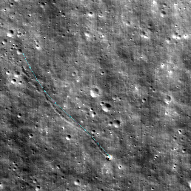
A bright block at the end of a 228-metre lunar trace.
An unsupervised search for visual abnormalities in recent Lunar Reconnaissance Orbiter imagery surfaced this candidate. Historical images then showed the same boulder and track already present in 2010.

The experiment
Looking for what the model did not expect
This work began as an experiment in unsupervised anomaly detection over recent LROC imagery: train on ordinary lunar terrain, rank the model’s largest prediction surprises, then inspect the most unusual patches rather than search for a predefined object class.
Candidate e824bf3ee775b25b10ab721b surfaced in the 17 March 2026 observation M1528367567RC. Its bright terminal object and a sequence of repeated-looking marks suggested a possible boulder and downhill track.
Preliminary finding
A real, persistent feature—not a 2026 image artefact
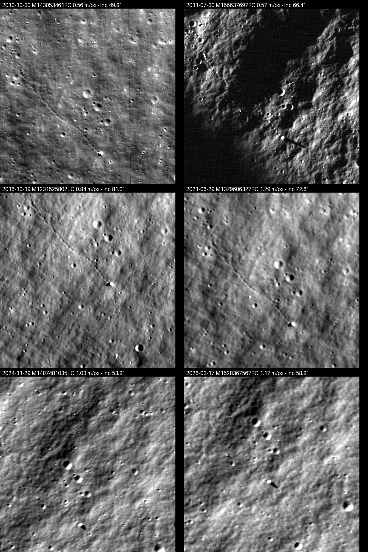
The strongest historical frame, acquired on 30 October 2010, shows a continuous, slightly sinuous trace terminating at a bright block with a cast shadow. The block remains visible under substantially different illumination in later observations through March 2026.
This supports a genuine transported boulder with a persistent track. It does not date the fall: the movement could be geologically old.
Explore the work
Three views of the same evidence
Historical evidence
Hold the terrain fixed while moving through six observations from 2010 to 2026.
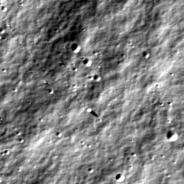
Image metrology
Inspect the provisional body centre, shadow endpoint, solar geometry and derived dimensions.
3D visible journey
Explore the registered trace over measured regional topography at a physically accurate default scale.
Historical test
Six independent views across changing light
All valid observations were projected north-up onto one fixed 0.5 m/pixel terrain grid. The changing solar angle makes individual frames look dramatically different; persistent morphology across them is the useful signal.
| Acquired | LROC CDR | Oblique resolution | Incidence | Weight |
|---|---|---|---|---|
| 2010-10-30 | M143053461RC | 0.556 m/px | 49.83° | Usable |
| 2011-07-30 | M166637697RC | 0.567 m/px | 66.41° | Usable |
| 2016-10-19 | M1231525802LC | 0.844 m/px | 80.96° | Caution |
| 2021-06-29 | M1379606327RC | 1.291 m/px | 72.59° | Usable |
| 2024-11-29 | M1487481035LC | 1.031 m/px | 53.83° | Usable |
| 2026-03-17 | M1528367567RC | 1.174 m/px | 58.78° | Usable |
Two acquired products were rejected during human review as image noise and are excluded from every evidence count and measurement.
Established locally
What the package supports
The feature exists in public native LROC data. Its clearest track is already present in 2010. The terminal block persists across independent observations, and the site is not within 1 km of an entry in either public Bickel CT ≥ 0.6 catalog.
Evidence boundary
What it does not yet prove
The package does not determine when the fall occurred, establish an origin point, or substitute for specialist geomorphological review. The trace, dimensions and bounce interpretation remain provisional. No official name or formal discovery status is implied.
Reproducible path
From model surprise to testable evidence
- The anomaly model ranked a recent 2026 LROC image patch without being trained to find boulders.
- Native source coordinates were recovered with ISIS 10, web SPICE and Kaguya terrain data.
- Eight covering NAC observations were acquired; human review rejected two invalid noisy frames.
- Six valid images were projected onto one fixed north-up 0.5 m/pixel comparison grid.
- Shadow and footprint measurements bounded a provisional 6–10 m body and approximately 5.9 m height.
- SLDEM2015 supplied the regional slope for a constrained 3D hypothesis, not a claimed dynamical reconstruction.